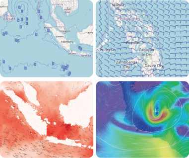
We deliver the information about your safety for your trip across the sea
Our best feature is weather impact which gives you information about the area to be avoided by the cargo, ship, passenger ships and fishing vessels.
Safety has been an essential subject matter in maritime. Accident impact assessment, safety analysis, risk mitigation, and management are key research topics in port and shipping. Nevertheless, naval transport operators and stakeholders are continuously challenged by various accidents and hazards.
"Maritime safety risk" provides the safety score for all the vessels that use AIS. A safety score calculates how the vessel's safety based on the height of the significant wave, wind speed & direction, and the sea currents condition. We deliver the information about your safety for your trip across the sea. Our best feature is weather impact which gives you information about the area to be avoided by the cargo ship, barges, passenger ships, and fishing vessels.
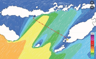
With weather maps you can :